 See Every Piece of Earth’s Surface Change With New Satellite Map
A huge trove of constantly updated data is now available to the public.
Source: National Geographic
A new global map made of more than two million satellite images, updated monthly, is now yours to explore. Starting today, Earth-imaging company Planet Labs is launching a web portal to its huge database of photos of Earth, giving the public an unprecedented view of the planet’s ever-changing surface.
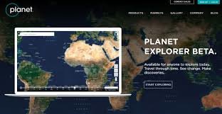
Using Planet Explorer Beta, you can see how any swath of land has changed over the last year, at monthly intervals. The company has built an automated system that sifts through millions of images collected by its satellites, selects the best ones, and stitches them together into a mosaic.
The entire globe is available at a resolution of 30 to 40 meters. The United States is available at three- to five-meter resolution—fine enough to pick out buildings, roads, even individual cars.
“This base map is a game changer,” says National Geographic cartographer Rosemary Wardley. “Having access to up-to-date imagery at such a high resolution is a tremendous asset to not only the field of cartography but for science as a whole.
“This base map is a game changer,” says National Geographic cartographer Rosemary Wardley. “Having access to up-to-date imagery at such a high resolution is a tremendous asset to not only the field of cartography but for science as a whole.
“The ability to toggle and compare dates and filter the imagery based on differing categories is an example of how far the world of GIS has come in the past decade. Image processing that used to take up the bulk of our time can now be done with the click of a mouse.”
Since its founding in 2010, San Francisco–based Planet Labs has aimed to capture a new image of Earth—every piece of it—every day.
 After launching 88 new satellites last month on an Indian rocket, the company now has 149 satellites in orbit, each just one foot long.
In three or four months, when the new additions to its fleet are fully operational, the company says there will be enough eyes on the planet to meet the goal of daily global coverage.
In three or four months, when the new additions to its fleet are fully operational, the company says there will be enough eyes on the planet to meet the goal of daily global coverage.


No comments:
Post a Comment