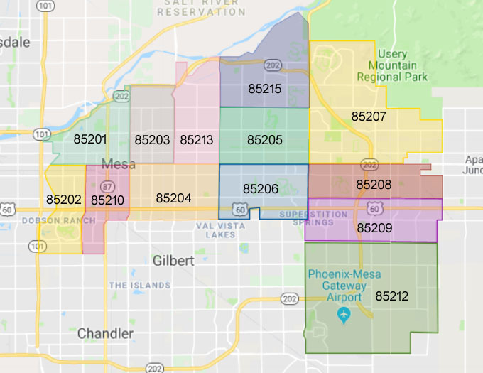
Please feel free to use it - for example zipcodes in Mesa City Council District 4

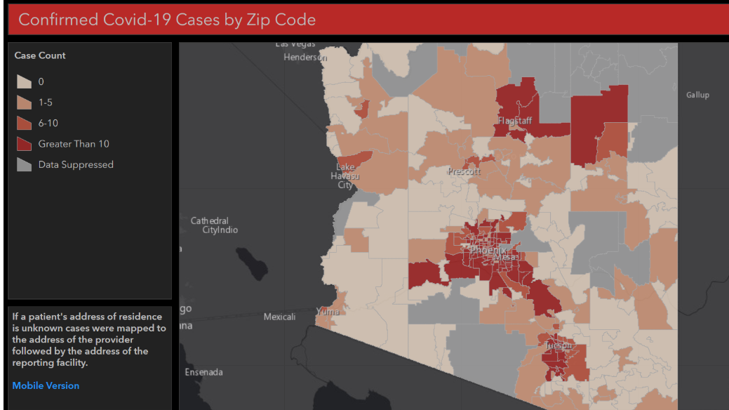
The Arizona Department of Health Services (ADHS) Geographic Information System (GIS)
Program supports the promotion and protection of the health of Arizonans through the collection, analysis, and visualization of data related to personal and community health.
THE TOWN OF GILBERT PUBLISHES A COVID-19 INFORMATION MAP
Image and Link:
___________________________________________________________________________________
UNEMPLOYMENT IMPACT MAP FROM MAG

More
ZIPCODES IN CITY OF MESA
MESA TOWNSHIP, RANGE AND BOUNDS
CITY OF MESA GIS MAPS


No comments:
Post a Comment