Monday, April 12, 2021
Backdrop to Climate Action > Flood Irrigation
Phoenix has a deep history of environmental injustice.
Low-income communities and communities of color suffer disproportionately from Phoenix’s extreme heat, a problem compounded by water access and affordability.
No one appears to have studied how flood irrigation correlates with wealth or race. Research indicates white, wealthier people are more likely to live in grassier, shadier neighborhoods. In one study from 2008, local researchers found that during one heatwave, the temperature discrepancy between a wealthier neighborhood and a poorer one in Phoenix hit 13.5F. Trees and grass accounted for the difference.
Whiter, wealthier people were more likely to have more vegetation, and in turn, cooler climates, the authors found. That study did not examine how greener areas were watered, but any irrigation has costs. “Affluent people ‘buy’ more favorable microclimates,” the researchers concluded.
Meet Arizona's water one-percenters
by Elizabeth Wang Whitman
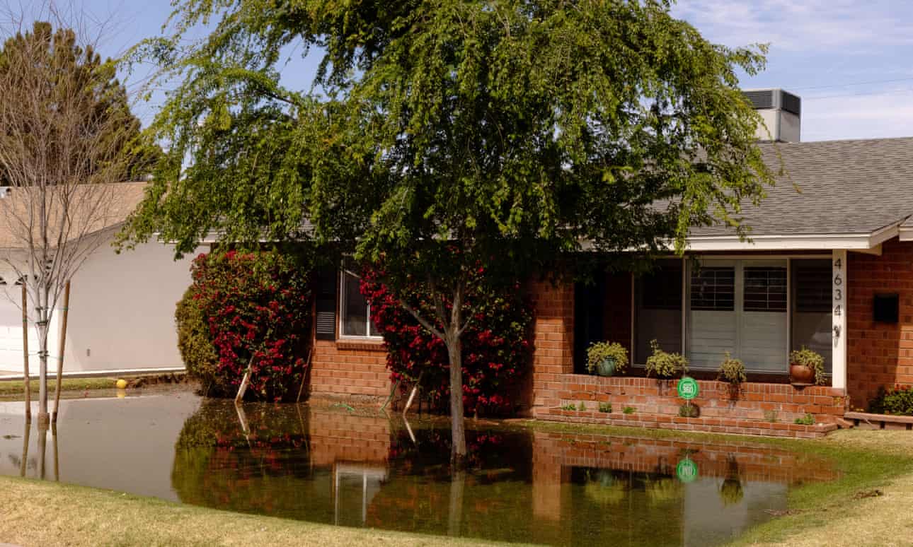
“You have to have irrigation boots, girl,” she says during a video tour of her property in Mesa, a suburb of Phoenix, Arizona. She flips her camera to reveal green grass, then tilts her phone skyward at four towering palm trees. As she walks, she pans across pecan, pomegranate, and citrus trees – lemon, orange, a grapefruit sapling. A tortoise, between 80 and 100lb, lumbers toward her, chewing. “There’s Simba,” Upton says. “Hey buddy! What is that, Simba? You can’t eat it.” She pats him affectionately on the head.
This lush half-acre is Upton and her husband’s oasis, fed by flood irrigation in the heart of the Sonoran desert.
Upton is among a handful of homeowners – by one accounting, just 1% – of metro Phoenix’s 4.4 million people to receive flood irrigation. The Salt River Project, the area’s largest supplier of such water, delivered almost 60,000 acre-feet of water to that small number of residents in 2019, or 7.5% of the water it delivered that year to all customers combined.
In that same year, the Salt River Project sent 36,003 acre-feet to Phoenix-area schools, parks, golf courses and churches (and 63,500 acre-feet to farmers – another story entirely) to irrigate trees and turf.
To provide scale for that type of usage: one acre-foot of water can sustain three Phoenix-area families for a year. The entire city of Chandler, Arizona, population 261,000, uses 60,000 acre-feet of water annually.
The water, untreated, is cheap. To flood her yard twice a week, except in winter, Upton pays $100 a year to Salt River Project and $350 to her subdivision’s irrigation water delivery district, a special taxation district she helped start. If it were city water, “we could never afford this,” Upton says. “It’d be over $600 a month.”
The total amount of raw water to irrigate lawns and trees in private homes, parks and schools has changed little in the last 36 years. Some people deem the practice a harmless anomaly. Others defiantly defend it against a backdrop of conservation messaging and intensive planning for climate change, drought and future water scarcity.
New Feature on This Blog: Earthquake Reports
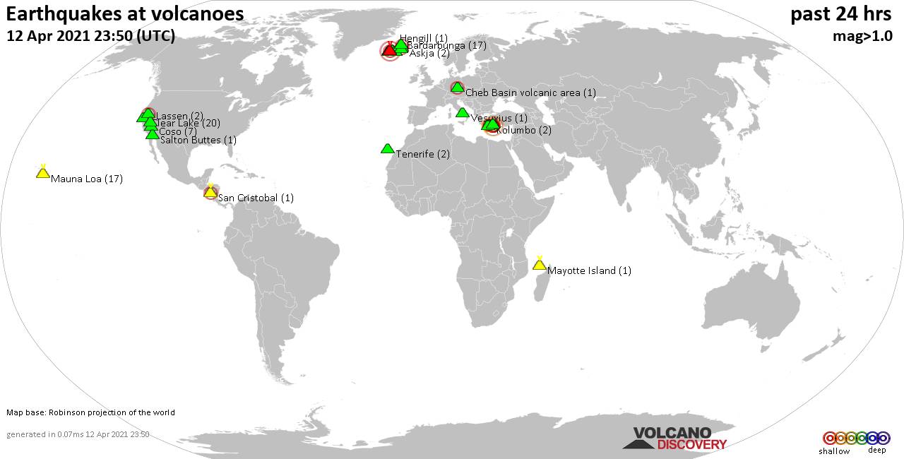
 Volcano earthquake report for Monday, 12 Apr 2021
Fagradalsfjall (2 quakes between mag 1.0-1.1), Hengill (1 quake mag 1.2), Herdubreid (3 quakes between mag 0.4-1.4), Hrómundartindur (8 quakes between mag 0.3-1.4), Katla (2 quakes between mag 1.1-1.1), Kolumbo (1 quake mag 2.5), Krísuvík (15 quakes between mag 0.1-3.5), Kverkfjöll (2 quakes between mag 0.6-1.0), Lassen (1 quake mag 2.4), Long Valley (9 quakes between mag 0.1-1.8), Mauna Loa (21 quakes between mag 0.7-1.5), Mono Lake (1 quake mag 1.0), Nisyros (8 quakes between mag 1.4-3.0), Penanggungan (1 quake mag 3.0), Piton de la Fournaise (2 quakes between mag 0.4-1.4), Reykjanes (8 quakes between mag 0.1-1.3), Rotorua (1 quake mag 3.0), Taupo (3 quakes between mag 1.2-1.8), Tjörnes Fracture Zone (1 quake mag 1.1), Vesuvius (4 quakes between mag 0.3-1.8) (updated 10h50)
Note: Earthquakes within 20 km from and at depths less than 20 km under active volcanoes are reported. The list is not complete because many volcanoes are not monitored and/or seismic data in high resolution is not available publicly.
Volcanoes with recent earthquakes above magnitude 2 or more than 10 quakes are listed below:
Cheb Basin volcanic area volcano (Czechia): magnitude 2.2 earthquake
A magnitude 2.2 earthquake occurred at the volcano 9 hours ago. The quake, which might be volcanic in origin, was located at a depth of 5.0 km depth at 10 km distance NNW from the volcano.Earthquake details:
2.2 quake 4.1 km southwest of Cheb, Karlovarský kraj, Czechia, 12 April 2021 02:01 GMT (10 km NNW) - 11 hours ago
All earthquakes at Cheb Basin volcanic area
Clear Lake volcano (California): 30 earthquakes up to magnitude 2.7
Possible earthquake swarm: 30 earthquakes occurred near (under) the volcano during 20 hours, the last being recorded quake 36 minutes ago. Hypocenter depths ranged between 5.8 and 1.2 km.Earthquake details: (only 5 largest)
2.7 quake Sonoma County, 14 mi southwest of Clearlake, Lake County, California, USA, 11 April 2021 22:03 GMT (16 km SSW) - 15 hours ago
2.5 quake 7km NW of The Geysers, CA, USA, 11 April 2021 22:57 GMT (17 km SSW) - 14 hours ago
2.4 quake 7km WNW of The Geysers, CA, USA, 11 April 2021 16:55 GMT (18 km SSW) - 20 hours ago
2.1 quake 7km NW of The Geysers, CA, USA, 11 April 2021 22:16 GMT (16 km SSW) - 15 hours ago
1.9 quake 6km WNW of The Geysers, CA, USA, 12 April 2021 08:08 GMT (19 km SSW) - 5 hours ago
All earthquakes at Clear Lake
Kolumbo volcano (Greece): magnitude 2.5 earthquake
A magnitude 2.5 earthquake occurred at the volcano 1 hour 34 minutes ago. The quake, which might be volcanic in origin, was located at a depth of 12.7 km depth at 7 km distance ENE from the volcano.Earthquake details:
2.5 quake Aegean Sea, 18 km northeast of Fira, Nomos Kykladon, South Aegean, Greece, 12 April 2021 09:16 GMT (7 km ENE) - 3 hours 53 minutes ago
All earthquakes at Kolumbo
Krísuvík volcano (Reykjanes Peninsula, Iceland): 15 earthquakes up to magnitude 3.5
Possible earthquake swarm: 15 earthquakes occurred near (under) the volcano during 23 hours, the last being recorded quake 1 hour 5 minutes ago. Hypocenter depths ranged between 7.4 and 1.0 km.Earthquake details: (only 5 largest)
3.5 quake 3.9 Km SE of Keilir, Iceland, 12 April 2021 03:26 GMT (1 km SSW) - 10 hours ago
1.4 quake 2.3 Km SSW of Keilir, Iceland, 12 April 2021 00:06 GMT (5 km W) - 13 hours ago
1.2 quake 2.7 Km E of Keilir, Iceland, 12 April 2021 02:10 GMT (1 km NW) - 11 hours ago
1.2 quake 0.4 Km WNW of Keilir, Iceland, 11 April 2021 12:43 GMT (4 km WNW) - 1 day 0 hours ago
1.0 quake 5.5 Km N of Krýsuvík, Iceland, 12 April 2021 09:11 GMT (2 km ENE) - 3 hours 58 minutes ago
All earthquakes at Krísuvík
Lassen volcano (California): magnitude 2.4 earthquake
A magnitude 2.4 earthquake occurred at the volcano 7 hours ago. The quake, which might be volcanic in origin, was located at a depth of 2.3 km depth at 9 km distance NW from the volcano.Earthquake details:
2.4 quake 10km ENE of Viola, CA, USA, 12 April 2021 03:30 GMT (9 km NW) - 10 hours ago
All earthquakes at Lassen
Mauna Loa volcano (Hawai'i (Big Island)): 21 earthquakes up to magnitude 1.5
Possible earthquake swarm: 21 earthquakes occurred near (under) the volcano during 18 hours, the last being recorded quake 6 hours ago. Hypocenter depths ranged between 10.1 and 1.5 km.Earthquake details: (only 5 largest)
1.5 quake Island of Hawaii, Hawaii, USA, 12 April 2021 04:40 GMT (17 km W) - 8 hours ago
1.2 quake 24 Km WNW of Volcano, Hawaii, USA, 12 April 2021 02:57 GMT (14 km E) - 10 hours ago
1.2 quake 26 Km N of Pāhala, Hawaii, USA, 11 April 2021 20:44 GMT (11 km ESE) - 16 hours ago
1.1 quake Island of Hawaii, Hawaii, USA, 11 April 2021 20:59 GMT (4 km W) - 16 hours ago
1.0 quake 22 Km ENE of Honaunau-Napoopoo, Hawaii, USA, 11 April 2021 14:33 GMT (8 km NW) - 23 hours ago
All earthquakes at Mauna Loa
Nisyros volcano (Greece): 8 earthquakes up to magnitude 3.0
8 earthquakes occurred near (under) the volcano during 17 hours, the last being recorded quake 3 hours ago. Hypocenter depths ranged between 14.3 and 3.9 km.Earthquake details: (only 5 largest)
3.0 quake Aegean Sea, 23 km west of Tilos Island, Dodecanese, South Aegean, Greece, 11 April 2021 16:40 GMT (13 km SSW) - 20 hours ago
2.9 quake Aegean Sea, 20 km west of Tilos Island, Dodecanese, South Aegean, Greece, 11 April 2021 15:07 GMT (13 km S) - 22 hours ago
2.7 quake Aegean Sea, 10.8 km west of Tilos Island, Dodecanese, South Aegean, Greece, 12 April 2021 00:46 GMT (19 km SSE) - 12 hours ago
2.2 quake Aegean Sea, 18 km west of Tilos Island, Dodecanese, South Aegean, Greece, 12 April 2021 01:01 GMT (16 km S) - 12 hours ago
2.1 quake Aegean Sea, 21 km west of Tilos Island, Dodecanese, South Aegean, Greece, 12 April 2021 07:32 GMT (16 km S) - 6 hours ago
All earthquakes at Nisyros
Penanggungan volcano (East Java): magnitude 3.0 earthquake
A magnitude 3.0 earthquake occurred at the volcano 20 hours ago. The quake, which might be volcanic in origin, was located at a depth of 10.0 km depth at 17 km distance SE from the volcano.Earthquake details:
Unconfirmed quake reported: Near Malang, East Java, Indonesia, 11 April 2021 14:40 GMT (17 km SE) - 22 hours ago
All earthquakes at Penanggungan
Rotorua volcano (New Zealand): magnitude 3.0 earthquake
A magnitude 3.0 earthquake occurred at the volcano 18 hours ago. The quake, which might be volcanic in origin, was located at a depth of 10.0 km depth at 6 km distance SE from the volcano.Earthquake details:
Unconfirmed quake reported: Near Rotorua, Bay of Plenty, New Zealand, 11 April 2021 16:40 GMT (6 km SE) - 20 hours ago
All earthquakes at Rotorua
Previous news
A Clean Energy Future For Vermont . . . .Here in Mesa, Arizona NO PLAN AT ALL
Vermont Electric Cooperative plans to go carbon-free by 2023

“We are moving quickly to reduce our impact on climate change, and doing it in a cost-effective manner,” said Rich Goggin, board president of Vermont Electric Cooperative. “Vermont has consistently been a leader in the move toward clean energy, and VEC is stepping up even more.”
Vermont’s goal to obtain 90% of its energy needs from renewable sources is one of the most ambitious in the country. To get there, transportation and thermal will have to be shifted onto a green grid.
Transportation and electricity are the state’s two largest sources of greenhouse gas emissions. Fossil fuels, such as coal and natural gas, account for about 63% of electricity production nationwide.
Carbon fees tacked onto buildings that use fossil-fuel heating systems — like those passed in Burlington this March — get at one side of the issue. Utility companies must also procure enough green energy to keep up with demand as more vehicles and heating systems are moved to the electric grid. . .
Vermont’s Comprehensive Energy Plan also includes a goal to have at least 50,000 electric vehicles on the road by 2025, but some officials within the Public Utility Commission have expressed doubt over whether that target can be met.
Only 3,971 electric vehicles were registered in Vermont as of July 2020, despite state incentives designed to encourage residents to buy or lease plug-in electric vehicles.
A 2019 report cited a lack of public charging stations among the chief roadblocks. Gov. Phil Scott announced 11 new plug-in electric vehicle stations in February, and Vermont already has the largest number of charging stations per capita in the country (114 per 100,000 people).
Burlington Electric Department went 100% renewable in 2014, making the city the first in the country to run its electric grid entirely off renewable sources. Washington Electric Cooperative and Swanton Electric have also reached the 100% mark.
Streaming clips
YouTube FilmIsNow Action Movies · 14 hours ago One Mission. One Island. No Way Out. | Dolph Lundgren | Full Movie Uploaded: Mar 28, 2026
-
 Flash News: Ukraine Intercepts Russian Kh-59 Cruise Missile Using US VAMPIRE Air Defense System Mounted on Boat. Ukrainian forces have made ...

