From Bloomberg yesterday:
GHGSat Inc. released a new methane map on Wednesday that uses data from the company’s two satellites, which were launched earlier this year and can detect methane emitted by oil and gas wells, coal mines, power plants, farms and factories. It’s part of a wave of climate surveillance that will make it possible to hold countries and companies accountable for meeting targets to reduce and eventually eliminate planet-warming pollution.
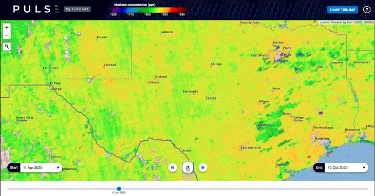
Timelapse of methane concentrations in Permian shale of West Texas and New Mexico from June through October.
Source: GHGSat Inc
Satellites Put the World’s Biggest Methane Emitters on the Map
Now the companies and countries responsible for a powerful greenhouse gas won’t be able to hide from view.
Satellites Put the World’s Biggest Methane Emitters on the Map
Now the companies and countries responsible for a powerful greenhouse gas won’t be able to hide from view.


No comments:
Post a Comment